
Open source maps and open data help humanitarian response: Open source maps and open data help humanitarian response hleson Fri, 03/24/2023 – 03:00
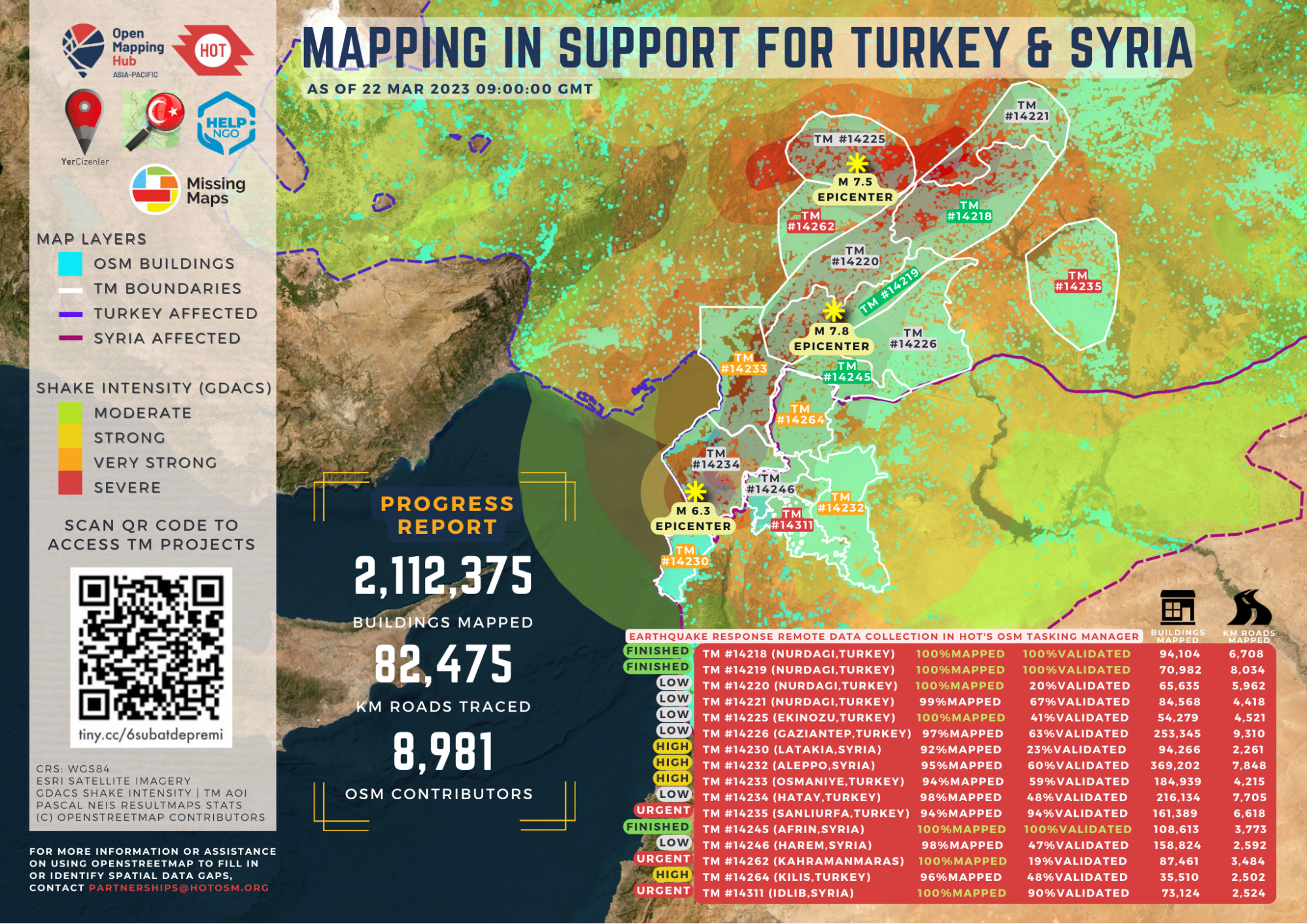
Every day people use “open” to have an impact in their world. The Türkiye and Syria Earthquake Response includes over 9,000 people editing OpenStreetMap (OSM), partners providing open licensed satellite imagery, people generating and using open data, all collaborating across open source tools, like the Tasking Manager. Having the most up-to-date and accurate map data helps humanitarian organizations and civil societies navigate the disaster areas, coordinate response, and conduct damage assessments. The OSM data is shared on the Humanitarian Data Exchange and is used to develop information management (IM) products for decision-makers. Some of the examples of information products are shared on these two open source built platforms: The Deep and the IFRC GO platform. Humanitarian OpenStreetMap Team (HOT) and the global OSM community are integral by connecting local communities and humanitarian organizations to urgent information.
A message sent by Dr Çevik, a Turkish surgeon treating people injured by the earthquake in Turkey, said (translated):
“In the first day I went to Reyhaniye, when Google Maps was not working, Organic Maps guided us. The importance of such tools is enormous. Good luck to you! —Can ? organic maps ?
OpenStreetMap and Organic Maps, a free privacy-focused fork of Maps.Me, were used in conjunction for localized response.
Dr. Uçum from Kahramanmara? talking about how maps from OSM data have helped logistics and operations in the camps. The maps were subsequently used by local authorities to support planning and infrastructure in the camp site.
How we coordinated
None of this happened over night. The success of OSM being integrated into a large scale active response is due to years of socialization and education on the part of OSM communities in Türkiye and beyond. Yer Çizenler, a local NGO within the OSM Türkiye community aiming to raise awareness on open data and open mapping in the country, activated community mapping, and has coordinated with HOT since the early hours following the earthquake. For Syria, mapping and coordination is more complex because it’s an ongoing conflict zone. HOT is working closely with OSM colleagues and partners to assess HOT tasks in Syria carefully. Precautions are taken to do no harm.
HOT’s workflow involves rendering satellite imagery into small tasks which are managed in the HOT Tasking Manager. These tasking manager tasks were created based on the initial response assessments. Further news about damage in the extended area led to creation of newer tasks. Community outreach and the call to action started. Tasks continue to evolve as needed with partner organizations.
Initially, national and international organizations contacted the OSM teams. Next, coordination and communication networks were formed for data and information sharing. Yer Çizenler and HOT started contacting imaging providers (such as ITU CSCRS) for post-event imagery availability. All satellite imagery with Creative Commons license are uploaded to OpenAerialMap, an open data platform by HOT to share data freely. Additionally, Help.NGO supported the community by uploading drone images taken from the field. Thanks to free and open software, community members such as people from Kontur (disaster ninja), Iconem (search-satellite-imagery), and leafmap (OAM update), integrations to downstream applications are quickly adapted to increase data accessibility and usability.
A national volunteer community consisting of more than 1,200 people gathered during the first week following the event. Mapping tasks were supported with daily “mapathons” guided by the local communities. Overall, in just one month the global OSM community contributors were 8,414 people, including mappers from every region.
Additional datasets with ODBL compatible licenses gathered, organized editing activities led to enhance the OSM database with collapsed buildings, temporary shelter areas, pharmacies, health institutions, bakeries, supermarkets, groceries, and so on.
Open organizations evolve over years
Key members and founders of Yer Cizenler first connected with OSM and humanitarian mapping following the Erci? earthquake in 2011. Over the following decade, they’ve organized workshops and mapathons with the mapping and tech communities of Turkey to build awareness and expand the OSM user base where the community mainly consisted of individual contributors without much coordination. Open organizations take time to grow. Can and Orkut represented and connected the OSM-TR community with universities, governmental organizations, professional chambers, and other open communities in Turkey.
They also connected with the international OSM community through the State of the Map annual conferences, WeeklyOSM meetings, and HOT.
Yer Çizenler was founded in 2017 in order to set up a legal entity within the TR community. That followed with partnership with HOT on multiple field projects until 2021. Yer Çizenler currently operates as an open mapping volunteer group, coordinating with civil actors, advocating open data and open mapping in Turkey. These efforts to advocate for open methodologies, open data, and open source laid the groundwork for the response.
As it is an active humanitarian response, the team is focused on coordinating with humanitarian and civil society organizations. In the coming weeks and months, their attention is on supporting the active response and engaging the volunteer community to be part of OSM-TR community. Additionally, they are engaged in continuous trainings, mapathons, talks, and more.
One long term goal of Yer Cizenler is the documentation of its open workflows, with lessons from this response highlighting how to incorporate open source, open data, and open methodologies. There’s much to learn on how to deliver interoperable and open solutions during emergencies to meet desperately important speed and quality of service. Please feel free to share additional examples in the comments.
Open source brings people together to provide aid in response to the earthquake in Turkey and Syria.

Opensource.com
 This work is licensed under a Creative Commons Attribution-Share Alike 4.0 International License.
I’m a passionate Geomatics Engineer, OpenStreetMap contributor and community builder. I love building maps and solving community problems by using my geospatial knowledge. I’m a strong believer that open data brings creativity, innovation and freedom to society. I evangelize open data initiatives and develop the OSM community growth strategies for Türkiye. Currently, I’m working as Project Manager at Meta’s Mapping team and based in London, United Kingdom.
– profile picture : please find it in the attachment
I’m a data scientist and Python developer, mostly educated with open materials on the web. Working in GIS with images ?
Graduated from YTU Geomatics Engineering Dept. and have been working on free software/free data/free hardware powered business since 2003. His focus is on R&D projects for technology companies, innovation projects for NGO’s and government agencies too. After having civil society and community experiences, he became one of the founding members of Yer Çizenler Mapping for Everyone Association in 2017. He is also the founder of GeoPerformans, a geospatial technology startup from Istanbul. He loves to talk about GNU/Linux, Drupal, PostGIS and OpenStreetMap.
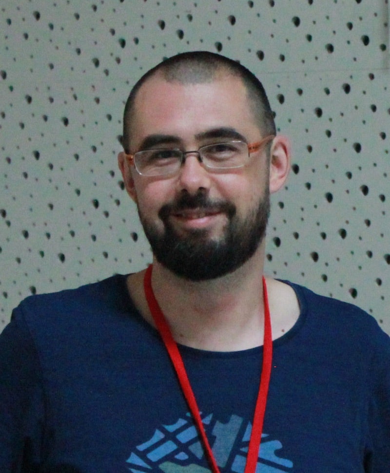
Based in Turkey, he got his B.Sc. degree in Civil Engineering from the Middle East Technical University in Ankara, and his Ph.D. in Geomatics from Istanbul Technical University, specializing in GIS-based applications in disaster management and seismic loss assessment. He also spent time at the University of Illinois at Urbana-Champaign (UIUC) as a visiting researcher at the Mid-America Earthquake Center during 2008 and 2009.
An OpenStreetMap contributor since 2012, and part of humanitarian open mapping communities since 2017, he has become part of open source and open data communities. He is one of the founding members of Yer Çizenler, a Turkish NGO within the OSM-TR community, and he is currently part of Open Mapping Hub Asia-Pacific team, in collaboration with the Humanitarian OpenStreetMap Team (HOT).
: Opensource.com hleson
Supporting Open Source.
Have you tried: Visiting Port Elizabeth?